Head to Head Walkway


Head to Head Walks
This recommended route is unmarked using existing asphalt footpaths and steps through the steep streets of historic Lyttelton.
Start at the northern end of Foster Tce and down to Randolph Tce; down Randolph then turn right at Watsons Lane to drop two blocks down to Sumner Road. Turn right and follow Sumner Road uphill, crossing at Oxford Tce to reach London St, the main shopping centre with a large choice of cafes and restaurants. Historic but humble Grubb Cottage is at 62 London Street.
Follow London Street for three blocks, turn left onto the historic Bridle Path, then follow this down until it becomes Cunningham Tce.
Follow Cunningham Tce around the bend to Simeon Quay, cross the road and turn right uphill then left onto Voelas Rd.
Go down one block then cross over and turn right onto Brittan Tce. Follow Brittan Tce until it becomes Park Tce. The entrance to the Coastal Path is at a white gate opposite 7 Park Tce.
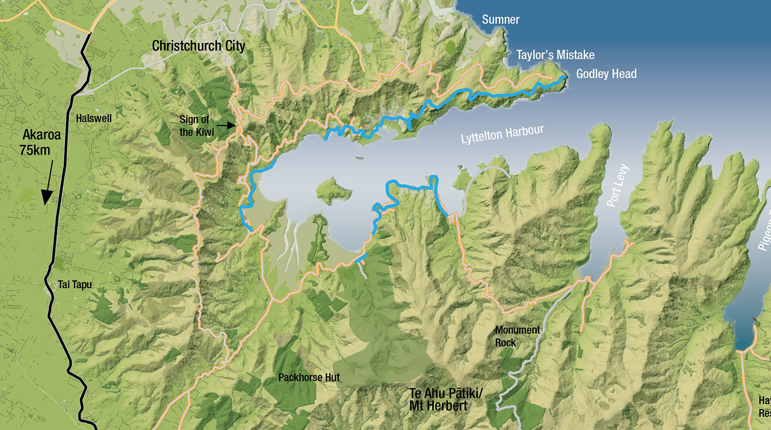
Click HERE to view the Christchurch City Councils interactive map.
Coastal, Historic, Road walking
Start a 7 Park Tce, Lyttelton. A coastal meander with views over Lyttlelton port visiting historic sites, sandy swimming beaches and ending at the Pony Point Reserve.
Magazine Bay to Motukauatiiti-Corsair Bay – 15 minutes passing through regenerating forest and pine trees before dropping down to the shore at Corsair Bay, a popular swimming and picnic spot, with toilets, a drinking fountain and pirate-themed playground.
Motukauatiiti-Corsair Bay to Motukauatirahi-Cass Bay – 20 minutes from the far side of Corsair Bay beach where it climbs into pine trees on to a longer, narrower section, steep in places with some steps. Cass Bay has a playground with a flying fox, toilets and a grey sands beach.
Motukauatirahi-Cass Bay to Otuherekio-Pony Point Reserve – 15 minutes one way
Walk to the far end of Cass Beach then a few metres up Bay View Place to pick up the well-formed track just above the playground and toilets. The track through Pony Point Scenic Reserve is a circuit track – a 30-minute round trip.
The left-hand route sidles above the boat sheds following the water edge before zig-zagging to reach the summit of the point to a picnic area with native plantings, a pou, and great harbour views.
The return track to Cass Bay follows the fence, descending through gum trees. You can also exit the reserve to Governors Bay Road from the top picnic area to a small pull-off for parking.
Route warning: During winter tracks can be wet and slippery so please proceed with caution.
Click HERE to view the Christchurch City Councils interactive map.
Native bush, Coastal, Historic, Track formed, Sign posted, Road walking
Dogs on short leash on beaches 1 Dec - 1 Mar, 9am - 7pm and at all times in Pony Point.
From the main road the track winds down the hill with steps and steep sections to the rocky area above the secluded beach. The track follows the cliff edge to Sandy Bay, a nice beach for swimming or kayaking. Note there is a Portaloo at Sandy Bay.
Take care – the track has some uneven surfaces and slippery sections. During winter tracks can be wet and slippery so please proceed with caution. Not suitable for wheelchairs or buggies.
Click HERE to view the Christchurch City Councils interactive map.
Native bush, Coastal, Track formed, Sign posted
Follow the water edge through the coastal bush before climbing some stairs to reach Jetty Road where there is a gate and small pull-off area to safely wait for traffic to pass.
Walk down Jetty Road for approximately 100m to the start of the Governors Bay Foreshore Track.
Sandy Bay has a great swimming beach.
Note this undulating single track is a little rough underfoot in places.
Click HERE to view the Christchurch City Councils interactive map.
Native bush, Coastal, Track formed, Road walking
Dogs prohibited on Governors Bay foreshore.
This track starts beside the Governors Bay jetty at the end of Jetty Road. It’s a gentle stroll around the foreshore along a wide, gravelled track, suitable for all ages and fitness levels. There are no beaches here but it’s great for spotting birdlife on the foreshore.
Note this is a shared-use track – bikes may be encountered.
Toilets are available at Allandale Reserve.
Click HERE to view the Christchurch City Councils interactive map.
Native bush, Coastal, Historic, Track formed, Sign posted
Dogs prohibited foreshore.
This new section of track is 1.2km and starts as a pole route across the golf course grass verge before turning into a track that runs past Orton Bradley Park. Though short, this section will eventually link to Paradise Beach.
Click HERE to view the Christchurch City Councils interactive map.
Coastal, Track formed, Sign posted
Access the track from Paradise Beach car park. Walk along the beach (a marked high tide option exists) before the track climbs and then descends on the Charteris Bay Yacht Club Road.
Follow the concrete road uphill, then take the marked track to Hays Bay. Cross the beach and continue around Black Point Reserve. The track eventually joins a wider gravel track that descends down to Church Bay where you can find the start of the Coastal Cliffs Walkway.
Route warning: During winter tracks can be wet and slippery so please proceed with caution.
Dogs prohibited on Hays Bay from 1 Nov- 31 Mar from 9am-7pm except for passing through where dogs must be on a short leash. Outside these times dogs are permitted under effective control.
Click HERE to view the Christchurch City Councils interactive map.
Native bush, Coastal, Track formed, Sign posted
- Diamond Harbour Eatery, 21 Waipapa Ave, Diamond Harbour 8972, 03 329 4465
- Department of Conservation – enquiries, 0800 275 362
- Lyttelton Harbour Information Centre, 20 Oxford Street, Lyttelton, 03 328 9093
- Download brochure
: Dogs prohibited on Hays Bay from 1 Nov- 31 Mar from 9am-7pm except for passing through.
Diamond Harbour Wharf to Purau Bay – 90 mins Head up the steps by the wharf and take the cliff side track around Te Upoko-o-Kurī/Stoddart Point. Follow the rough track above the water edge through pine forest with stunning views of the harbour and Ripapa Island – once an important pā site for Ngāi Tahu, it later became a quarantine station, a prison and then a fort. The track emerges on Purau Ave just shy of the bay – follow the road to the sandy beach.
Toilets at a small beach just before Diamond Harbour Wharf, in Stoddart Point Recreation Reserve and at Purau Bay.
Route warning: During winter tracks can be wet and slippery so please proceed with caution.
Click HERE to view the Christchurch City Councils interactive map.
Native bush, Coastal, Historic, Track formed, Sign posted, Road walking
Effective control. Dogs are prohibited from the Coastal Cliff Reserve and foreshore.
Head to Head Tramps/Hikes
Godley Head is a fantastic starting point for the Head to Head Walkway offering views across the harbour to Banks Peninsula. Built in 1939 the WWII coastal defence battery site is ranked in the top ten New Zealand coastal defence heritage sites. Check the DOC website for more detailed information about the Godley Head site.
From Godley Head car park, climb the Crater Rim Track on the Lyttelton side then sidle around under some steep bluffs above Breeze Bay before climbing again to wind above the cliffs to Livingston Col. Walk along the ridge before dropping down beside a stock fence for about 1 km to meet the Summit Road at a cattle stop just above Evans Pass.
Walk down the Summit Road, crossing Evans Pass to pick up the Crater Rim again off Summit Road about 50 metres downhill.
Pass through Buckleys Bay Scenic Reserve before reaching the junction with Urumau Reserve Track (currently not signposted). If you hit Chalmers Track you have missed this junction.
Click HERE to view the Christchurch City Councils interactive map.
Native bush, Coastal, Summit, Historic, Track formed, Sign posted, Road walking
Located on the prominent lava flow ridge that borders Lyttelton the track is challenging with some rocky sections that require some scrambling, but includes some magnificent vistas.
Start at the Crater Rim Track junction, descending steeply to Lyttelton township, coming out at the northern end of Foster Terrace.
Route warning: During winter tracks can be wet and slippery so please proceed with caution.
Click HERE to view the Christchurch City Councils interactive map.
Native bush, Summit, Sign posted